Go to Batch > Select Locations ![]()
This function will allow the user to select the start location, any via's and the end destination point from a gazetteer. This will allow users to specify Norwich as a start point and Masons Island as the end point. The system will then produce a route from one to the other.
The following dialog is displayed:
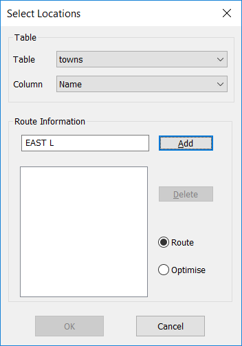
| 1. | Select the table from the drop down list. |
| 2. | Select the column that contains the identifiers (e.g. Town) |
| 3. | Type in the name of the first location. |
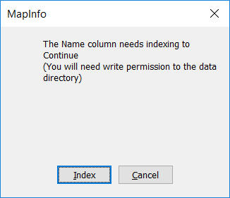
You may need to allow any column used to be index in order for this option to find it
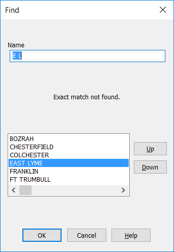
| 4. | Click on the "Add" Button. If the location is not found in the table then close matches are displayed for the user to select from |
| 5. | The location is displayed in the list box. |
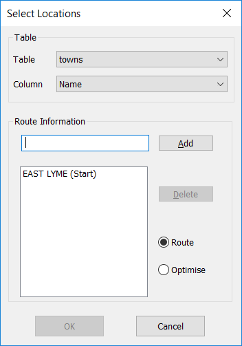
| 6. | Repeat steps 3-5 to add locations. At least two must be selected. |
| 7. | Select between generating a "Route" and/or optimizing the route between the selected points. |
| 8. | Click on the OK button and the locations are processed and displayed on the map. |
| 9. | If you add a location by mistake then you can select the location from the list box and then press the Delete button. |