Once a network has been opened, you can do various calculations.
At first we do distance matrices only. Later on these gets added:
Nearest N centres
Travelling Salesman
Coordinates
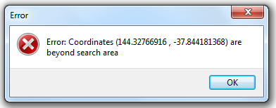
For all calculations involving a point table as input, your table should be in the same coordinate system as the street network.
I.e. no coordinate transformations are done.
If you try to mix them anyway, you will get an error that the coordinates of your point data are outside the search area.
In this example the point table is in Lat/long data, while the street network is a local projection: