At RouteWare website you will find a list of street data providers for various parts of the world. Data from these providers usually have a topological correct structure, which means they are almost ready to use in RW NetServer.
But how should your own street data look like, in order to be used in RW NetServer? The short answer is they should snap and split at intersections and the network should be plane unless there is an overpass.
Below is shown some examples on networks, which are NOT correct, but all look correct unless you check out the details:
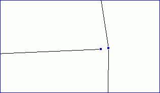
Example 1: Missing snap at an intersection
This means the network doesn't connect and the movement to / from the disconnected section, isn't possible. In the example below, the gap is just 1 meter and can't be seen at normal zoom levels.
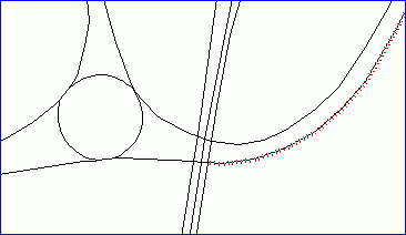
Example 2: Split at overpass / underpass
This means a lot of impossible turn movements are suddenly made possible. This is a typical problem with TIGER data.
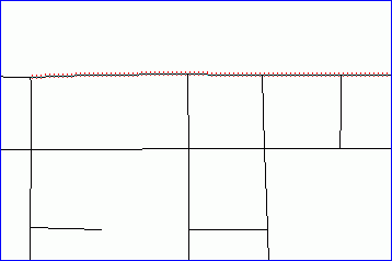
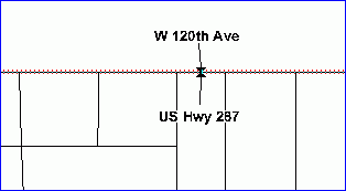
Example 3: Doesn't split/break at intersections
This means turns are not possible at most intersections.
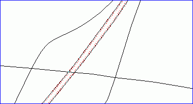
Example 4: Double digitization with two street names, here name + route number
Not a really big problem, but the result of a route calculation may include one of the two streets in a more or less random fashion.
Example 5: Multi sectioned polylines
Polylines with more than 1 section are ignored. They will not be part of any route.